
Can Drones Cut Construction Costs? Smart Construction, Drone Surveying and the US and UK Rules
- Smart construction links sensors, phones and drones to manage a site in real time.
- Drones cut labour and time, reach unsafe areas and help set rescue priorities.
- In the US and UK, pilots need FAA or CAA credentials and must follow flight rules.
Contents
Does someone really have to dangle from a rope to inspect a crumbling façade or a steep, unstable slope? On more and more building sites the answer is no: a drone goes up, the foreman watches the live feed on a tablet, and nobody climbs anything. This guide reworks a Korean student report on smart construction into a clear explainer: what smart construction means, why drones cut costs, how surveyors make drone maps accurate, how Korea compares with other countries, and how the rules work in the United States and Britain.
What is smart construction?
The report defines smart construction as a site where Internet of Things sensors, phones, smartwatches and drones feed information into one system, so that the whole project can be managed in real time. The key idea is speed: what used to be noted on clipboards and passed along at the weekly meeting is now collected and shared the moment it happens. A crane operator, a safety manager and a client can all look at the same picture of the site at once.
Student money tip from CampusDown Repair UpMy Apartment Smelled Like Ramen and Old Socks — Stuffy apartment air fixes on a budget: open windows safely, run the range hood, cut pollution sources, control moisture, and know when to…
The report quotes experts who expect efficiency across the industry to rise by around half once these tools are widely adopted, and construction costs to fall noticeably as a result. That figure is an informed guess rather than a measured result, so it is best cited as an expectation. The author's own interest started with a simple experiment: flying a drone around their school building in a smart architecture class and realising how much of the structure could be seen in minutes.
Korea's transport ministry set out its plan in a 2018 smart construction technology roadmap, which aims to bring digital design, automated equipment and real-time site monitoring together step by step, with heavy automation as the long-term goal. The roadmap is the reference the report relies on and a sensible starting point for any assignment on the topic.

Why do drones make building cheaper and safer?
The report lists five practical savings. A drone survey needs far fewer people, so labour costs fall. Flights are short, which shortens the schedule and the bill. Cameras reach parts of a building that are almost impossible to check by eye, such as roof edges or the underside of a bridge deck. A single flight can cover a wide area quickly. Most importantly, a drone can enter zones that have not yet been made safe for people, which removes workers from some of the most dangerous moments on a site.

The relaxed faces in the picture are the real benefit. When a survey that once meant scaffolding and a full day of climbing becomes a twenty-minute flight, the team can spend its energy on decisions instead of access.
The same aerial view also matters when things go wrong. After a collapse, landslide or flood, a drone can show rescuers within minutes where people may be trapped and which routes are still passable, helping them set priorities for evacuation and rescue. That is why the report treats drones as a tool for both cost control and safety management.
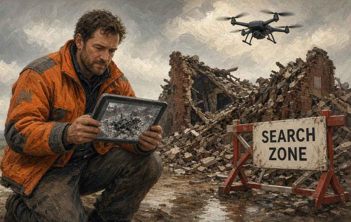
In the scene above, the rescuer is not looking at the rubble but at the screen. The bird's-eye picture is what lets a small team decide where to start digging before the light fades.
Skimming the section headings first makes a long guide much easier to map out. Try writing down one question of your own as you read.
How do surveyors keep drone maps accurate?
A drone photo is only useful for engineering if every pixel can be tied to a real position on the ground. Surveyors do this with ground control points, or GCPs: precisely measured markers laid out across the site that appear in the aerial images and pin the resulting map to real coordinates. Without them, a 3D model can look perfect and still be off by enough to misplace a foundation.
The report describes sites where reference markers contain NFC tags. A worker taps the marker with a smartphone, reads its stored position and pulls up its details in an app or on the web. Using these electronic markers as GCPs for drone mapping, the report argues, keeps accuracy high while saving the time normally spent measuring markers from scratch. Accuracy is not a nice extra here; it is the condition that makes drone surveying usable in real contracts.
Anyone flying commercially also needs the right licence. Our guide to the Korean drone pilot certificate explains the categories in Korea, and the next section covers the American and British equivalents.
How do the US and UK regulate construction drones?
United States: Part 107 and Remote ID
In America, commercial drone work, including site surveys and roof inspections, falls under the Federal Aviation Administration's Part 107 rules, in force since 2016. The person flying needs a Remote Pilot Certificate, earned by passing an aeronautical knowledge test. The basic rules keep small drones below 400 feet above ground, within the pilot's visual line of sight and away from people who are not involved, unless the operation meets extra conditions or holds a waiver. Most drones must also be registered and broadcast Remote ID, a kind of digital licence plate that lets authorities identify an aircraft in flight.
Large contractors have folded drones into routine progress reporting, comparing weekly flights with the design model to spot delays early. Safety managers also value roof and façade inspections that keep crews off ladders, since falls remain one of the most common causes of death on American sites.
United Kingdom: CAA IDs and categories
In Britain, the Civil Aviation Authority runs a two-part identity system. Most drone owners need an Operator ID, which is labelled on the aircraft, while the person flying needs a Flyer ID earned through an online theory test. Low-risk flights sit in the open category, with sub-categories based on how close the drone flies to people. Site work near buildings or crowds often needs further training, such as the A2 Certificate of Competency or the General Visual Line of Sight Certificate, and higher-risk jobs move into the specific category, which requires an operational authorisation.
The UK construction sector has pushed digital working through building information modelling, and drones fit neatly into that approach by feeding regular survey data into the shared model. On both sides of the Atlantic the lesson is the same: the technology is ready, and the paperwork and training are part of the job.
How does Korea compare with other markets?
| Issue | Korea | United States | United Kingdom |
|---|---|---|---|
| Main use in the report's data | Filming and agriculture lead; construction lags | Surveying, inspection and progress tracking are common | Surveying and inspection linked to digital building models |
| Pilot qualification | Drone pilot certificate under aviation safety law | FAA Remote Pilot Certificate (Part 107) | CAA Flyer ID, plus further certificates for riskier work |
| Aircraft identity | Registration for larger drones | Registration and Remote ID | Operator ID labelled on the drone |
| Policy push | 2018 smart construction technology roadmap | Industry-led adoption | Government and industry digital construction strategy |
The report's own figures show the contrast it wants to make. It cites data suggesting that, worldwide, more than half of industrial drones work in construction, civil engineering, surveying and mapping, while in Korea more than 30 percent are used for filming in broadcasting, marketing and content, and more than 20 percent for monitoring and spraying crops. Those shares come from the source and will have shifted since, but the pattern explains why the author sees construction as Korea's underused opportunity.
The bigger problem, according to the report, is that most Korean sites still use drone footage only to look at and support decisions. Even when a site collects images for many standard work types, the data has little effect unless it flows into scheduling, quantity checks and quality control. The gap is less about the aircraft than about connecting its data to everyday processes.
How should you structure a report on construction drones?
A tidy order is: define smart construction, explain the cost and safety benefits, show how accuracy is secured, compare Korea with other countries, then set out the challenges. That flow lets the reader see how technology and cost are linked rather than reading a list of gadgets. Site safety is a natural thread to carry through, and our page on the construction safety engineer qualification shows how safety specialists fit into Korean sites.
Student money tip on CampusDown Repair Up: My Apartment Smelled Like Ramen and Old Socks.
- Have you defined smart construction before discussing drones?
- Have you separated measured results from experts' estimates?
- Have you explained ground control points in plain words?
- Have you dated any statistics you quote?
- Have you proposed how drone data could join real work processes?
A strong conclusion goes one step further and suggests a concrete link, for example using weekly flight data to update quantities in the cost plan automatically.
Who will find this useful?
This structure suits students in architecture, civil engineering and construction management, as well as anyone writing a technology report for a smart city or engineering course.
FAQ
Do I need a licence to fly a drone on a US construction site?
Yes. Commercial flights fall under FAA Part 107, so the pilot needs a Remote Pilot Certificate and must follow its operating rules.
What do I need to fly a drone for work in the UK?
Usually an Operator ID and a Flyer ID from the CAA, plus further training such as the A2 CofC or GVC for riskier site work.
What is a ground control point?
A precisely measured marker on the ground that appears in aerial photos and ties the drone map to real coordinates.
How much can smart construction save?
The source cites experts who expect efficiency gains of around half; treat this as an estimate rather than a measured result.
Why are construction drones less common in Korea?
The source's data shows filming and farming dominate drone use there, and site footage is rarely linked to work processes.